CHAPTER VII
THE CLEVELAND HILLS
|
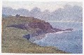
On their their northern and western flanks the Cleveland Hills have a
most imposing and mountainous aspect, although their greatest altitudes
do not aspire more than about 1,500 feet. But they rise so suddenly to
their full height out of the flat sea of green country that they often
appear as a coast defended by a bold range of mountains. Roseberry
Topping stands out in grim isolation, on its masses of alum rock, like a
huge seaworn crag, considerably over 1,000 feet high. But this strangely
menacing peak raises its defiant head over nothing but broad meadows,
arable land, and woodlands, and his only warfare is with the lower
strata of storm-clouds, which is a convenient thing for the people who
live in these parts; for long ago they used the peak as a sign of
approaching storms, having reduced the warning to the easily-remembered
couplet:
|
|
    'When Roseberry Topping wears a cap,
     Let Cleveland then beware of a clap.'
In a similar manner the Scarborough folk used Oliver's Mount, the
isolated hill at the back of the town, as a ready-made barometer, for
they knew that
  'When Oliver's Mount puts on his hat,
   Scarborough town will pay for that.'
It is difficult to decide on the correct spelling of Roseberry Topping,
as it is often spelt in the same way as the earldom, and as frequently
in old writings it appears as 'Rosebury.' Camden, who wrote in Tudor
times, called it Ounsberry Topping, which certainly does not
help matters.
From the fact that you can see this remarkable peak from almost every
point of the compass except south-westwards, it must follow that from
the top of the hill there are views in all those directions. But to see
so much of the country at once comes as a surprise to everyone.
Stretching inland towards the backbone of England, there is spread out a
huge tract of smiling country, covered with a most complex network of
hedges, which gradually melt away into the indefinite blue edge of the
world where the hills of Wensleydale rise from the plain. Looking across
the little town of Guisborough, lying near the shelter of the hills, to
the broad sweep of the North Sea, this piece of Yorkshire seems so small
that one almost expects to see the Cheviots away in the north. But,
beyond the winding Tees and the drifting smoke of the great
manufacturing towns on its banks, one must be content with the county of
Durham, a huge section of which is plainly visible. Turning towards the
brown moorlands, the cultivation is exchanged for ridge beyond ridge of
total desolation—a huge tract of land in this crowded England where the
population for many square miles at a time consists of the inmates of a
lonely farm or two in the circumscribed cultivated areas of the dales.
Eight or nine hundred years ago these valleys were choked up with
forests. The Early British inhabitants were more inclined to the
hill-tops than the hollows, if the innumerable indications of their
settlements be any guide, and there is every reason for believing that
many of the hollows in the folds of the heathery moorlands were rarely
visited by man. Thus, the suggestion has been made that a few of the
last representatives of now extinct monsters may have survived in these
wild retreats, for how otherwise do we find persistent stories in these
parts of Yorkshire, handed down we cannot tell how many centuries, of
strange creatures described as 'worms'? At Loftus they show you the spot
where a 'grisly worm' had its lair, and in many places there are
traditions of strange long-bodied dragons who were slain by various
valiant men.
When we remember that the last wolf was killed in Scotland in the
seventeenth century, that Africa is still adding to the list of living
animals, and that the caves at Kirkdale, near Kirby Moorside, revealed
the bones of elephants, tigers, hyenas, and rhinoceroses, in an
excellent state of preservation, though they were all broken, we are
inclined to believe that these strange stories may have had some
basis of fact.
On Easby Moor, a few miles to the south of Roseberry Topping, the tall
column to the memory of Captain Cook stands like a lighthouse on this
inland coast-line. The lofty position it occupies among these brown and
purply-green heights makes the monument visible over a great tract of
the sailor's native Cleveland. The people who live in Marton, the
village of his birthplace, can see the memorial of their hero's fame,
and the country lads of to-day are constantly reminded of the success
which attended the industry and perseverance of a humble Marton boy.
The cottage where James Cook was born in 1728 has gone, but the field in
which it stood is called Cook's Garth. The shop at Staithes, generally
spoken of as a 'huckster's,' where Cook was apprenticed as a boy, has
also disappeared; but, unfortunately, that unpleasant story of his
having taken a shilling from his master's till, when the attractions of
the sea proved too much for him to resist, persistently clings to all
accounts of his early life. There seems no evidence to convict him of
this theft, but there are equally no facts by which to clear him. But if
we put into the balance his subsequent term of employment at Whitby, the
excellent character he gained when he went to sea, and Professor J.K.
Laughton's statement that he left Staithes 'after some disagreement with
his master,' there seems every reason to believe that the story is
untrue. If it were otherwise, the towering monument on Easby Moor would
be a questionable inspiration to posterity.
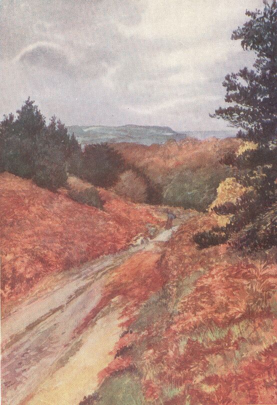
I have seldom seen a more uninhabited and inhospitable-looking country
than the broad extent of purple hills that stretch away to the
south-west from Great Ayton and Kildale Moors. Walking from Guisborough
to Kildale on a wild and stormy afternoon in October, I was totally
alone for the whole distance when I had left behind me the baker's boy
who was on his way to Hutton with a heavy basket of bread and cakes.
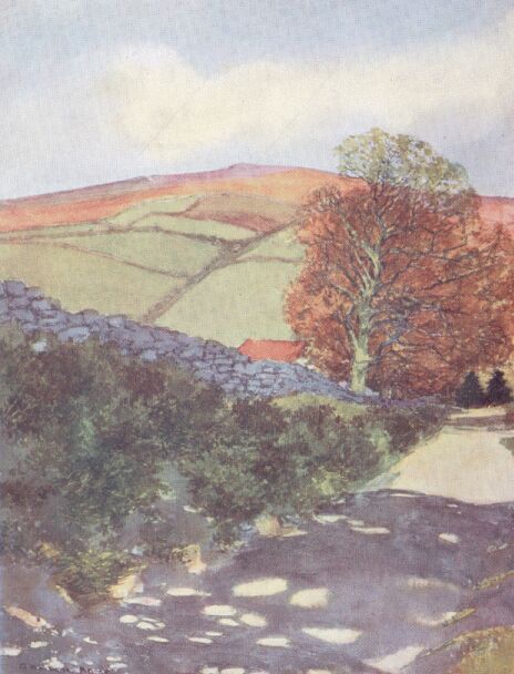
Hutton, which is somewhat of a model village for the retainers attached
to Hutton Hall, stands in a lovely hollow at the edge of the moors. The
steep hills are richly clothed with sombre woods, and the peace and
seclusion reigning there is in marked contrast to the bleak wastes
above. When I climbed the steep road on that autumn afternoon, and,
passing the zone of tall, withered bracken, reached the open moorland, I
seemed to have come out merely to be the plaything of the elements; for
the south-westerly gale, when it chose to do so, blew so fiercely that
it was difficult to make any progress at all. Overhead was a dark roof
composed of heavy masses of cloud, forming long parallel lines of gray
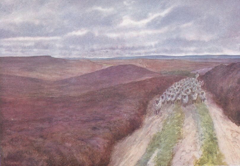
right to the horizon. On each side of the rough, water-worn road the
heather made a low wall, two or three feet high, and stretched right
away to the horizon in every direction. In the lulls, between the fierce
blasts, I could hear the trickle of the water in the rivulets deep down
in the springy cushion of heather. A few nimble sheep would stare at me
from a distance, and then disappear, or some grouse might hover over a
piece of rising ground; but otherwise there were no signs of living
creatures. Nearing Kildale, the road suddenly plunged downwards to a
stream flowing through a green, cultivated valley, with a lonely farm on
the further slope. There was a fir-wood above this, and as I passed over
the hill, among the tall, bare stems, the clouds parted a little in the
west, and let a flood of golden light into the wood. Instantly the gloom
seemed to disappear, and beyond the dark shoulder of moorland, where the
Cook monument appeared against the glory of the sunset, there seemed to
reign an all-pervading peace, the wood being quite silent, for the wind
had dropped.
The rough track through the trees descended hurriedly, and soon gave a
wide view over Kildale. The valley was full of colour from the glowing
west, and the steep hillsides opposite appeared lighter than the indigo
clouds above, now slightly tinged with purple. The little village of
Kildale nestled down below, its church half buried in yellow foliage.
The railway comes through Eskdale from Whitby to Stockton-on-Tees, and
thus gives the formerly remote valley easy communication with the
outside world. It is dangerous, however, not to allow an ample margin
for catching the trains, for there are only two or three in each
direction in the autumn and winter, and a gap of about four hours
generally separates the trains. I had been a long ramble over the moors
on the north side of Eskdale, and had allowed the sun to set while I was
still drawing on the top of Danby Beacon. But, having a good map with
me, I was quite confident of finding the road to Lealholm without
difficulty, as the distance was only a very few miles.
The crimson globe in the west disappeared behind the dark horizon over
the two Fryup valleys, and left the world in twilight. But it would not
be dark for an hour, and except for mistaking the sheep for boulders and
boulders for sheep, and being consequently surprised when what I had
imagined was a mass of gray stone suddenly disappeared on my approach,
nothing unusual happened. I had no fear of losing my way, but what my
map had led me to believe would be a plain road was a mere track in the
heather, and at times it became too indistinct to follow easily.
Lealholm Station lay in the valley on my right, but I could find no road
leading there, and I wasted precious time in frequent consultations with
the map. Coming to a farm, I inquired the way, and was directed over a
number of muddy fields, which gradually brought me down into the valley.
It was now sufficiently dark for all the landmarks I had noticed to be
scarcely visible, but, on inquiring at a cottage, I was told that it
would take only ten minutes to walk to the station. I had a clear
quarter of an hour, and, hurrying forward, soon found myself on a
railway-bridge over a deep cutting. There was just enough light to see
that no station was in sight, and it was impossible to find in which
direction the station lay. There was no time to go back to the cottage,
and there were no others to be seen. Looking at the map again, I could
not discover the position of this bridge, for it was on no road, as it
seemed merely to connect the pastures on either side. However, I felt
fairly certain that I had rather overstepped the station, and therefore
climbed down the bank into the cutting, and commenced walking towards
the west. Coming out into the open, I thought I saw the lamps on the
platforms about half a mile further on; but on pressing forward the
lights became suddenly bigger, and in a minute my train passed me with a
thundering rush. Evidently Lealholm was to the east, and not the west of
that cutting. It was then 5.40, and the next train left for Whitby at
about a quarter to ten. When the tail-lights of the train had
disappeared into the cutting, I felt very much alone, and the silence of
the countryside became oppressive. It seemed to me that this part of
Yorkshire was just as lonely as when Canon Atkinson first commenced his
work in Danby parish, and I was reminded of his friend's remark on
hearing that he was going there: 'Why, Danby was not found out when they
sent Bonaparte to St. Helena, or else they never would have taken the
trouble to send him all the way there!'
The ruined Danby Castle can still be seen on the slope above the Esk,
but the ancient Bow Bridge at Castleton, which was built at the end of
the twelfth century, was barbarously and needlessly destroyed in 1873. A
picture of the bridge has, fortunately, been preserved in Canon
Atkinson's 'Forty Years in a Moorland Parish.' That book has been so
widely read that it seems scarcely necessary to refer to it here, but
without the help of the Vicar, who knew every inch of his wild parish,
the Danby district must seem much less interesting.